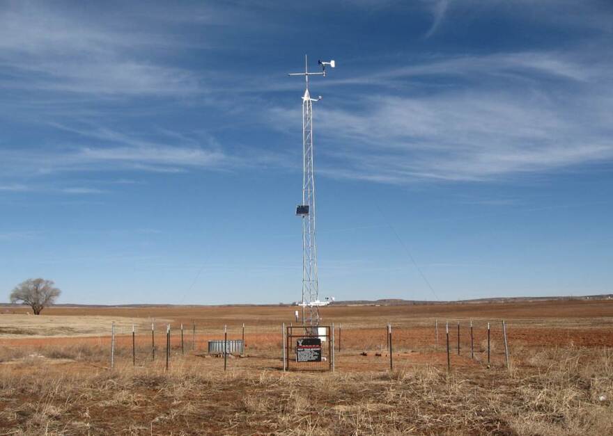
After snow buried Buffalo in November, Governor Cuomo said the development of a state-wide weather detection system will lead to better forecasting.
The statewide network of weather monitoring stations is called the mesonet.
Typically, each station’s a thirty-three-foot high tower in the middle of a clearing, equipped with all kinds of weather instruments like temperature gauges and wind vanes.
With access to only 27 of these stations in the state right now, meteorologists working on the project are excited about creating a denser network. Chris Thorncroft is one of them. He says eventually there’ll be 125 stations across New York - at least one in each county.
"In order to know what's really happening associated with a strong storm, we need a high concentration of observations around the state to see that. So we could have a storm moving over the state that is dropping a load of rainfall in a location and we currently don't see it.”
Each of these stations would collect data and transmit it to a central computer, where it would be checked for accuracy and then shared with the public.

Governor Cuomo has said the data collected by the mesonet would help better predict storms. Chris Thorncroft says more quality data is always good, but these systems would actually be best at understanding what's happening right now - like the technological equivalent of sticking your hand out the window, if your hand was equipped with thousands of dollars’ worth of environmental sensors. Thorncroft says this information has several applications. including enabling emergency management services to respond faster. In the future, he says his network would also help measure the effects of climate change on the state.
The New York State Mesonet isn’t the first of its kind. The University at Albany is modeling much of the network after Oklahoma’s, and other states like Texas, California and Iowa have their own mesonets in place. But New York's mesonet would be the most sophisticated developed so far. Seventeen of the 125 weather stations would be outfitted with laser technology, capable of recording atmospheric data up to six miles high. Why us that such a big deal? Because it’s the biggest innovation to how that information is gathered in more than 100 years.

Jason Franklin is the meteorologist in charge at the National Weather Service in Buffalo. They’re one of three sites across the state that uses weather balloons.
“Twice a day, one staff member goes over to our shelter and fills up the balloon with helium, and then attaches the instrumentation to it, and then lets it go.”
The instruments transmit data back to the ground as they disappear into the atmosphere. The National Weather Service reports only about 20% of that equipment ever finds its way back home. Not only does this cost over 350,000 dollars a year, Chris Thorncroft says it doesn’t even provide adequate information on the atmosphere over the state.
“Instead of having three sites twice a day, we're going to have seventeen sites every five minutes. And, we like to use the word game changer.”
These special stations, called profiling stations, could help meteorologists determine the difference between a snow storm and an ice storm, for instance. They could also have non-weather related uses, like tracking the movement of toxic chemicals in the event of a terrorist attack or industrial accident.


